
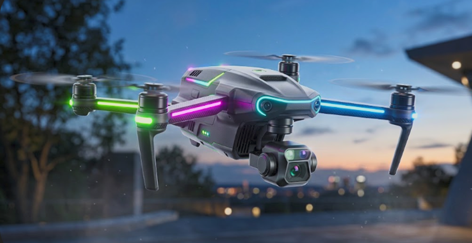
Unmanned aerial vehicles have ceased to be a mere technological curiosity to become one of the most powerful and versatile tools of the 21st century. From cinematic landscapes captured at the summit of mountains to frantic races in abandoned warehouses, and high-precision industrial inspections, the spectrum of drone applications is now infinite. This rapid democratization is accompanied by major challenges, both in terms of developing onboard technologies and structuring the airspace. Understanding the current drone ecosystem requires diving into the heart of hardware innovations, analyzing the strict regulations that govern their flight, and discovering the thrilling subcultures that push the limits of speed.
Technological Evolution: Artificial Intelligence and Miniaturization
The true revolution of modern drones lies not only in their ability to fly but in their capacity to analyze and understand their environment in real-time. Extreme component miniaturization has made it possible to embed ultra-powerful onboard computers into frames weighing sometimes less than 250 grams.
Navigation systems today rely on multiple satellite constellations (GPS, Galileo, GLONASS) coupled, for professional models, with RTK (Real-Time Kinematic) modules. This technology corrects satellite signaling errors via a ground station, offering centimeter-level positioning accuracy. This reliability is crucial both for precision mapping and for flight stability in challenging weather conditions.
Obstacle avoidance has taken a decisive leap forward with the integration of omnidirectional stereoscopic visual sensors, infrared sensors, and LiDAR (Light Detection and Ranging) technology. These systems continuously map the three-dimensional space. The drone’s artificial intelligence then uses this instantaneous topographical data to autonomously recalculate its trajectory, dodging branches, cables, and buildings, even in total darkness. Automated subject tracking relies on neural networks capable of recognizing human shapes, vehicles, or animals, dynamically adjusting the camera framing and flight path without any manual intervention from the pilot.
In terms of optics, the industry has achieved the feat of integrating three-axis stabilized mechanical gimbals housing 1-inch CMOS sensors, or even full-frame sensors. These optical modules record video feeds in 8K or 4K HDR at high frame rates, capturing an immense dynamic range. Simultaneously, video transmission has been transformed. Ultra-robust digital communication protocols now allow a high-definition live video feed to be transmitted over distances exceeding 15 kilometers, while maintaining almost imperceptible latency.
Uses and Applications: A Multidisciplinary Transformation
The impact of drones extends far beyond recreational photography. They have become indispensable data carriers, radically transforming the working methods of many traditional industries.
In the audiovisual field, they have democratized aerial shots once reserved for blockbusters renting helicopters. The ability to position a camera anywhere in space offers creators unprecedented narrative freedom, from live sports coverage to non-intrusive wildlife documentaries.
The industrial sector uses drones for technical and critical missions:
- Infrastructure Inspection: Equipped with thermal cameras and powerful optical zooms, they inspect wind turbine blades, bridge structures, high-voltage lines, and refinery flares. They detect micro-cracks or thermal anomalies while eliminating fall risks for human operators.
- Photogrammetry and Topography: By flying over a terrain in an automated grid, the devices capture thousands of images which, when assembled by specialized software, generate 3D digital twins accurate to the millimeter, revolutionizing construction and architecture surveys.
- Precision Agriculture: Multispectral sensors analyze the chlorophyll index of crops. This data detects water stress, nitrogen deficiencies, or diseases before they are visible to the naked eye. Large-scale drones then spray targeted treatments down to the centimeter.
- Logistics and Medical Emergencies: Drone delivery has moved beyond the experimental stage. While consumer goods delivery is gradually developing, the transport of blood bags, medical samples, or defibrillators to isolated areas is already an operational reality that saves lives.
- Search and Rescue Missions: Civil security services use thermal drones to locate missing persons in forests, day or night, or to map the spread of a fire to optimally coordinate ground teams.
Regulation and Security: The European Legal Framework
Faced with the growing congestion in the lower layers of the airspace, authorities have structured strict regulations to ensure the safety of manned aircraft, people on the ground, and the inalienable respect for privacy. The European Union, under the aegis of EASA (European Union Aviation Safety Agency), has harmonized its rules around a risk-based approach to the mission.
The legislation divides operations into several categories, the most common for the general public and independent creators being the « Open » category, designed for low-risk flights. This category is structured around drone classes, defined by their mass and capabilities:
- Class C0 (under 250 grams): These ultra-light devices benefit from the most flexible rules. They can fly over isolated individuals (but never gatherings) and do not require complex training or exams for the remote pilot, facilitating the democratization of the discipline.
- Classes C1 to C4 (from 250 grams to 25 kilos): Constraints increase drastically with weight. The pilot must pass a certified online training course, succeed in a theoretical exam, and respect strict setback distances from people and residential, commercial, or industrial areas (subcategories A1, A2, A3).
- Identification and Registration: Regardless of the drone’s weight, once it is equipped with a sensor capable of collecting personal data (a camera or a microphone), the operator has the legal obligation to register on national portals and affix their official identification number on the device’s frame. Recent models also integrate electronic remote identification.
Complex professional flights (flying over dense urban areas, prolonged beyond-visual-line-of-sight flights, dropping loads) fall into the « Specific » category. They require prior declarations, detailed operations manuals, and often an in-depth risk analysis according to the SORA (Specific Operations Risk Assessment) methodology. Furthermore, flying over public spaces is subject to digital aeronautical charts that define restricted zones, such as airport approach corridors, military bases, prisons, nuclear power plants, and national parks. Finally, respecting image rights and privacy remains paramount; capturing identifiable properties or people without explicit consent exposes the operator to heavy penal sanctions.
Speed, FPV, and Competition: Pure Adrenaline
Alongside stabilized drones designed for static or smooth shooting, a parallel universe runs on pure adrenaline: the FPV (First Person View) drone. This discipline radically transforms piloting into a visceral experience. The pilot wears a closed headset that broadcasts in real-time what the camera lens captures, offering the perfect physiological illusion of being inside the aircraft’s cockpit.
Unlike consumer models, FPV racing drones are often assembled from scratch by their owners (DIY). They are deliberately stripped of all standard flight assists. There is no automatic barometric altitude hold, no stabilization GPS, and no obstacle avoidance sensors. Piloting is done entirely in « Acro » (acrobatic manual) mode. This approach requires hundreds of hours of training on virtual simulators to develop lightning-fast muscle memory, capable of simultaneously managing pitch, roll, yaw, and throttle.
The mechanical performances of these machines defy the laws of consumer physics. A standard five-inch racing drone, equipped with powerful brushless motors and very high discharge rate Lithium-Polymer (LiPo) batteries, boasts a dizzying power-to-weight ratio, vastly superior to that of a hypercar. They can go from 0 to 100 km/h in less than two seconds, with top speeds reaching 150 km/h, or even crossing the 200 km/h mark for aerodynamically profiled models during straight-line accelerations.
This quest for absolute speed has given rise to professional e-sports and physical leagues, such as the DRL (Drone Racing League) or the DCL (Drone Champions League). In these televised competitions, the best pilots on the planet face off on complex three-dimensional circuits, navigating through glowing neon gates installed in stadiums, abandoned factories, or dense forests. The slightest trajectory deviation at 130 km/h results in the instant destruction of the carbon fiber frame.
First-person view flying has also established itself as a cinematic revolution. « Cinewhoops, » small FPV drones whose propellers are protected by cylindrical ducts, allow for incredibly smooth, close-up tracking shots that were previously impossible. They dive down sheer cliffs, follow rally cars just inches from the bumper, and infiltrate through a building’s window to tour a complex set interior in a single uninterrupted take, redefining the visual grammar of modern cinema.
The drone industry finds itself at the convergence point between mature technology and increasingly organic integration into society. The era when these machines were merely considered experimental flying toys is definitively over. Whether it is securing industrial sites, optimizing agricultural yields to feed the planet, pushing the boundaries of cinematic art, or experiencing the raw thrill of acrobatic flight at 150 km/h, the drone has established itself as a natural extension of human capabilities. The horizon is now shifting towards automated networks managed by artificial intelligence, urban passenger transport (eVTOL), and the development of solid-state batteries that will multiply flight endurance, promising to redraw the geography of our skies once again.